INDEPENDENT STUDIOOWNED PRODUCT · LIVE
All Labs workPolitipuls
A free map and iOS app built from public Politiloggen data.
01 / PRODUCT
PUBLIC DATA
SOURCE
Public incidents in one place.
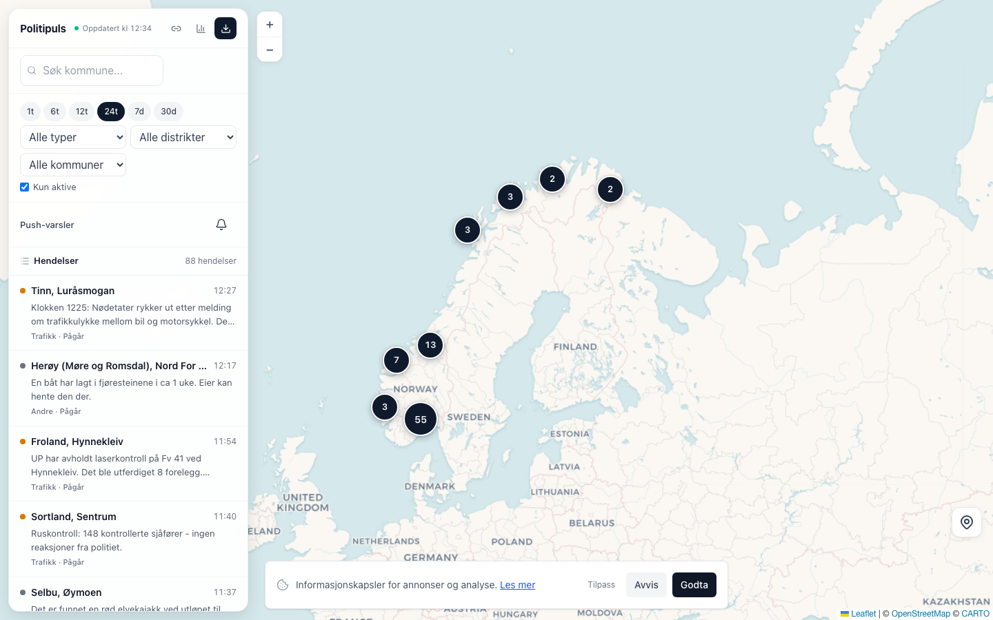
Politipuls reads the public Politiloggen feed and puts incidents from all 12 police districts on one map. The same interface lets people filter by time, category, district and municipality.
COVERAGE
12 police districts
One map across Norway instead of twelve separate district views.
SURFACES
Web + iOS
The service is available in a browser and through the iOS app.
SOURCE
Politiloggen
The incidents come from the Police's public event log.
02 / USE
FILTERS + MAP
HOW IT WORKS
Filter by place, time and incident type.
The current web interface shows incident rows beside the map. Filters narrow the view without changing the public source material behind it.
Map and timeline
Map clusters and incident rows stay visible in the same view.
Web and iOS
Both surfaces present the same type of public incident information.
03 / STATUS
FREE
CURRENT STATUS
Free and ad-supported.
Politipuls states that it is free and financed through Google AdSense. This case makes no paid customer claim and does not present a paid tier.
OPEN PRODUCTOpen the current Politipuls mapTECHNICAL STACK
Tools and services used.
- Astro
- Cloudflare Workers
- D1
- Swift / iOS